How Do Drone Surveys Work?
Technology has evolved a great amount in recent years, enabling us to do things that once would have seemed impossible. Drones in particular have helped various industries soar to new heights, and they are quickly becoming the go-to tool for surveying services.
If you work in engineering, construction, land & property development or property consultancy, you’ve probably asked yourself, “How does drone surveying work and how beneficial can it be?” Drone surveying is still a relatively new concept, and there’s not a huge amount of information out there detailing the ins and outs of the service and its benefits.
Using drones for surveys will soon become the norm, though, and it’s important that you have a thorough understanding of how drone surveying works, so you can feel confident in the choices you have and that all your needs are being met.
To give you a better idea of how the process works in the UK, this blog has been written, detailing what a drone survey is, how drone surveying works and the legal requirements.
What is a Drone Survey?
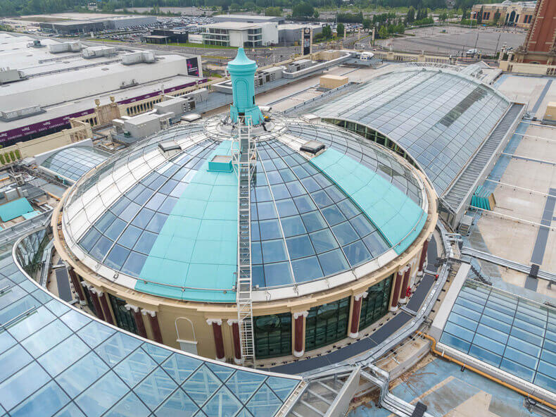
A drone survey (also known as an aerial survey) provides you with data of a building, structure or landscape with the aid of an Unmanned Aerial Vehicle (UAV). UAVs have sensors and cameras attached to them, which gather footage and readings of your subject from various different heights and angles.
After the data is captured, you can then write a detailed inspection report based on the findings. This will help you determine the next course of action and the best route to take.
Aside from standard photographs and video, different UAVs, cameras and sensors can be used to capture different types of data. This data can be in the form of photogrammetry and topographical surveys, or further into very specialised LIDAR, thermal and multispectral imaging using specialist software to create highly accurate 3D details of your project.
How Do Drone Surveys Work?
Once a drone is up in the air, it can start to capture data and footage integral to your survey. The equipment attached to the UAV can record photographs, video, other imagery, measurements and statistics to give you a complete overview of your project. Drone surveying features are perfect for:
-
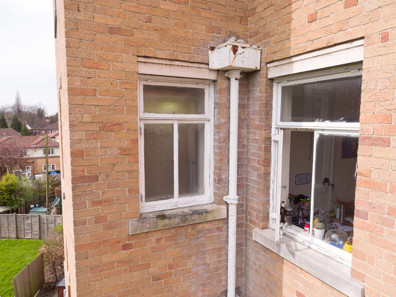
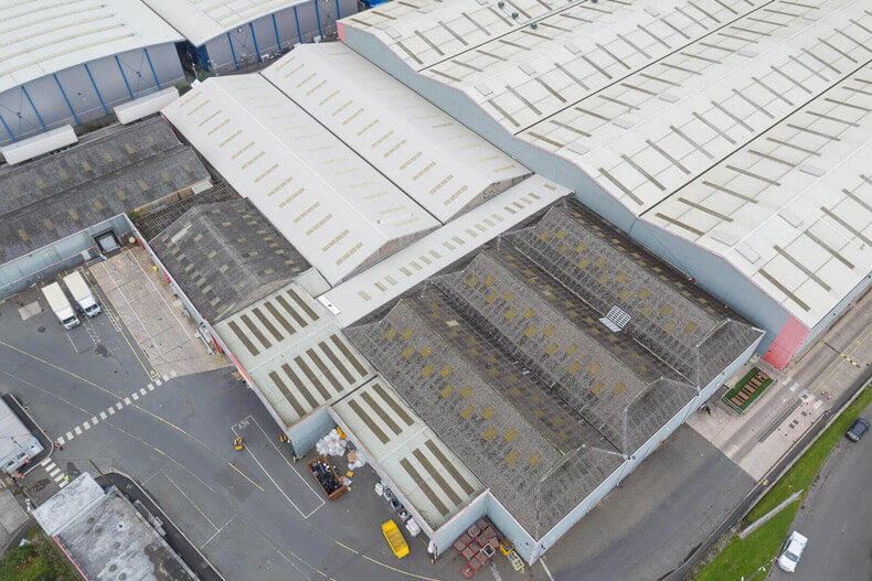
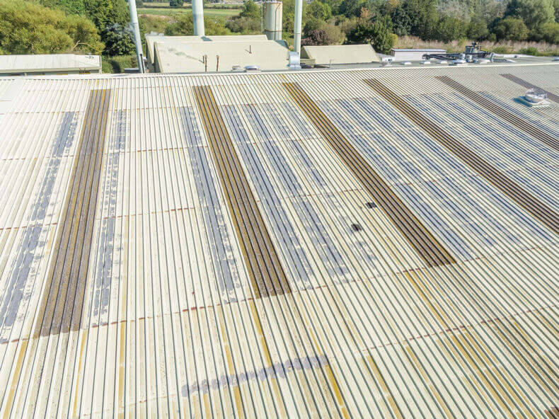
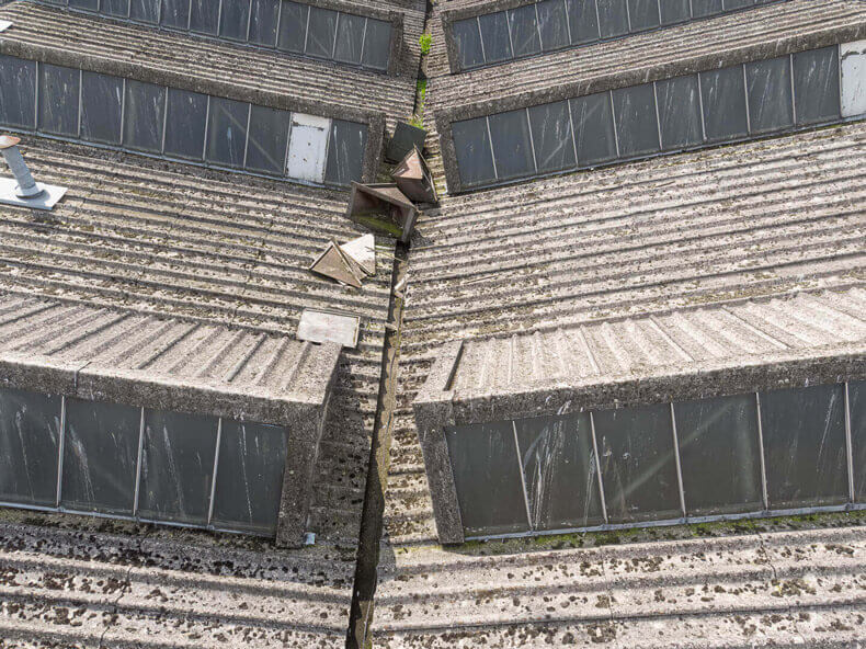
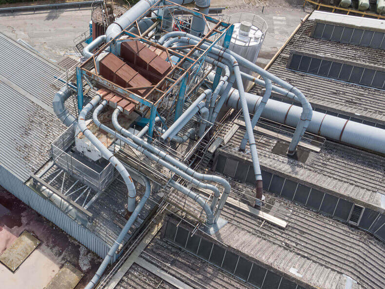
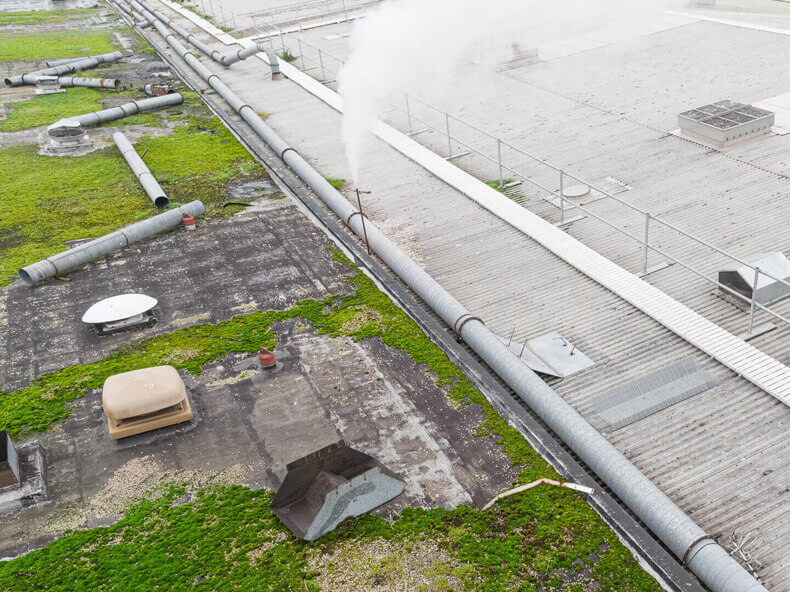
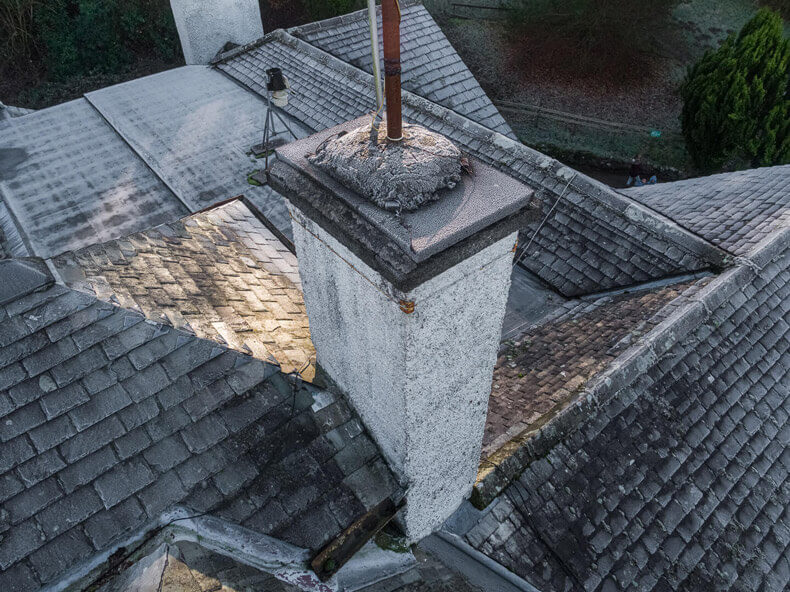
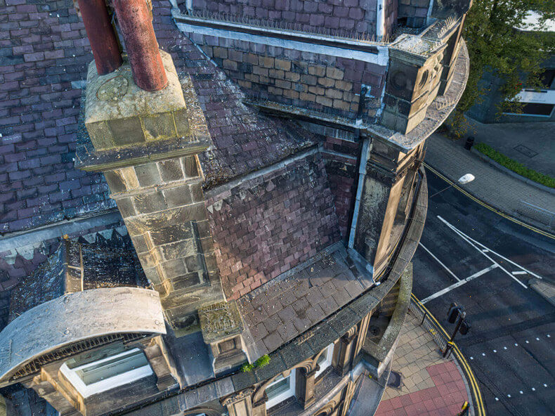
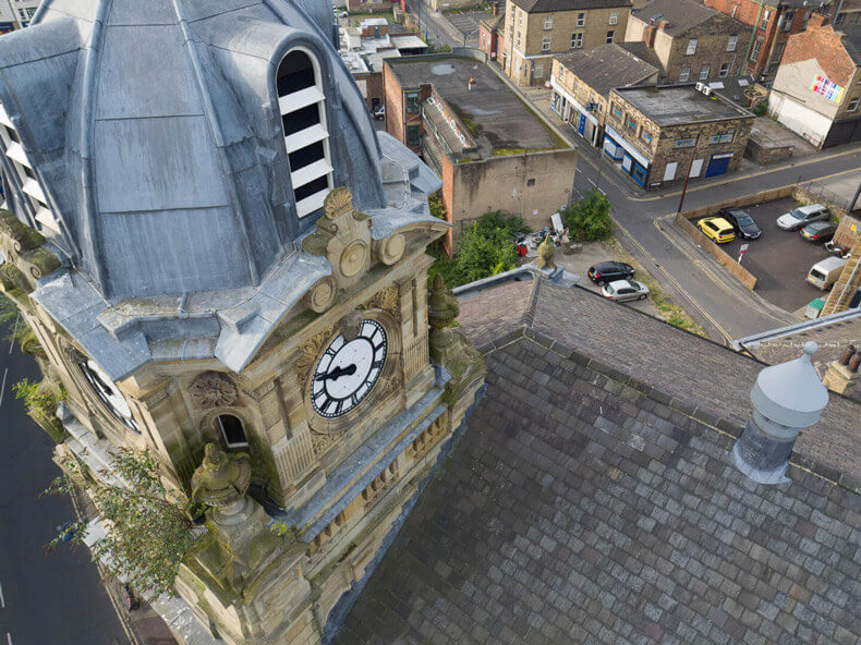
Condition surveys of roofs and other high level building elements including windows, brickwork etc
-
Documenting difficult to access or unsafe structures
-
Schedules of Dilapidation and Party Wall surveys
-
Construction site quality inspections
-
Utilities asset inspections
-
Rural and remote access surveying or engineering projects
-
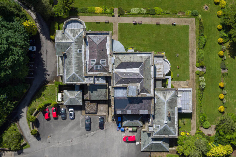
Land surveying, photogrammetry & topography
-
Pre-start ground condition surveys for construction and civil engineering projects
-
Finding accurate distances between two spaces and collecting surface measurements
-
Determining volumetric measurements (such as the depth of a quarry) and site materials
-
Slope monitoring and coastal erosion
Why is Drone Surveying Becoming More Popular?
When compared to traditional surveying methods, a drone offers more benefits. The plus points to drone surveying include:
-
Safety: At-height work — such as roof inspections and surveys to unsafe structures — can be high risk. Using a drone to capture footage is much safer for your team, minimising the risk by undertaking all work from safety and distance at ground level.
-
Speed: A drone can survey a huge development, structure or piece of land in a relatively short amount of time. Using a drone is much quicker than erecting temporary scaffolding, maneuvering access platforms, using cherry pickers or surveying land using traditional methods. It’s also worth remembering road closure notices, scaffolding permits etc. are not required in built up areas / town centres.
-
Convenience and Mobility: Drones can capture areas, details and views that other forms of access or methods cannot match
-
Cost-effectiveness: One drone can gather the same amount of data, if not more, than traditional surveying methods. Drones are far quicker and require less manpower, allowing the members of your team to carry on with other important tasks.
Who Can Benefit From Drone Surveys?
Drone surveys can be conducted to assist professionals across the entire built environment sector. Many of Midi Aerial Photography’s own clients work as:
-
Building Surveyors
-
Civil Engineers
-
Construction Managers
-
Site Managers
-
Land Surveyors
-
Property / Land Developers
-
Commercial property owners
-
Maintenance Surveyors
-
Facilities Managers
What are the Legal Requirements for Drone Surveying?
As useful as drone surveying is, it’s not something that anyone can do legally. There are many aspects to piloting a UAV, and drone operators need to prove their competency to the Civil Aviation Authority before they can take on commercial jobs. This ensures a professional handles all your aerial surveying needs efficiently and with safety in mind.
Permission for Commercial Operations (PfCO)
A drone operator can only carry out commercial work in the UK after being granted a CAA Permission for Commercial Operations (PfCO). These are Standard Permissions that mean the operator is allowed to fly a drone with the following conditions:
-
Operate at least 50m from any person, vessel, vehicle or structure that isn’t under the control of the operator (ie. anything you don’t have permission to fly near), or 150m from a crowd of more than 1,000 people
-
Must not exceed the maximum height of 400m
-
Must not exceed the maximum horizontal distance of 500m
-
The operator must have drone specific insurance
As skillful as a UAV operator with Standard Permissions is, there’s always a chance other factors may dictate whether your survey can be carried out to full completion. These operators have a legal obligation to keep their distance in built-up, congested areas, but a drone operator with Extended Permissions (officially known as an Operating Safety Case) has the authority to get much closer to other structures and developments.
An Operating Safety Case (OSC)
To get the most detailed survey possible in a built-up or busy area, a drone would inevitably need to fly close to other buildings or people, much closer than the 50m distance that comes with Standard Permissions. The CAA will allow operators to do this, but only the most highly skilled are granted an Operating Safety Case. This means they can fly closer than 50m to other buildings and vehicles without seeking permission from the owners.
Applying for an OSC is a time-consuming and thorough process. It takes a lot of hard work and patience to see it through to completion. Operators looking to gain an OSC have to approach the CAA with a series of highly detailed documents explaining their processes & procedures for flying, their understanding of current legislation and how they can prove they are a safe and competent flyer.
Operators also have to go into extreme detail to show they understand the operational functions and limitations of their drone. Finally, they have to produce a Safety Risk Assessment that will explain how they will assess and minimise risk when on a job.
In all, the documents cover over 120 pages of highly detailed competency and safety procedures. Being granted an OSC is incredibly difficult and costly, and only the most dedicated drone operators achieve this feat.
Midi Aerial Photography has been granted a CAA OSC and can operate drones at a minimum of 10m from other buildings, people etc at take-off, and 30m during flight.
How Does Drone Surveying Work For You?
Using a drone for surveying is an excellent way to get extremely accurate results in a safe, speedy and cost-effective manner. However, to get the most detail in built-up areas, town centres, and similar locations, instructing a drone operator who has Extended Permissions to work in these challenging environments and who also has extensive related experience in the built environment is a wise choice.
With over 15 previous years as a Building Surveyor and Project Manager under my belt, plus four years as a specialist drone operator, I have the skills and knowledge to survey every aspect of your project. Clients such as Peel Group, Intu Properties plc, Jones Bros and Arcadis have all benefited from my expertise, and now you can, too.
For a safe, accurate and cost-effective drone survey, make sure to get in contact with the details of your enquiry.